Maps of regions are an invaluable resource for studying the history of British Columbia, as they offer a comprehensive view of the area's physical and cultural landscapes. By examining these maps, historians can identify patterns of settlement and migration, trace the development of transportation networks and urban centers, and understand the relationships between different communities and regions. Maps can also provide insights into the natural resources and industries that have shaped the region's economy, from forestry and mining to fishing and agriculture. Moreover, maps can reveal the impact of political and social changes on the landscape, such as the effects of colonization and the displacement of Indigenous peoples. By analyzing maps of regions in British Columbia, historians can gain a deeper understanding of the forces that have shaped the region's history, and develop a richer appreciation for its diverse cultural and geographic heritage.
Trading Posts
This is a map of explorers - Please click on the map above for a new page with a large, detailed Map.
1407-1905
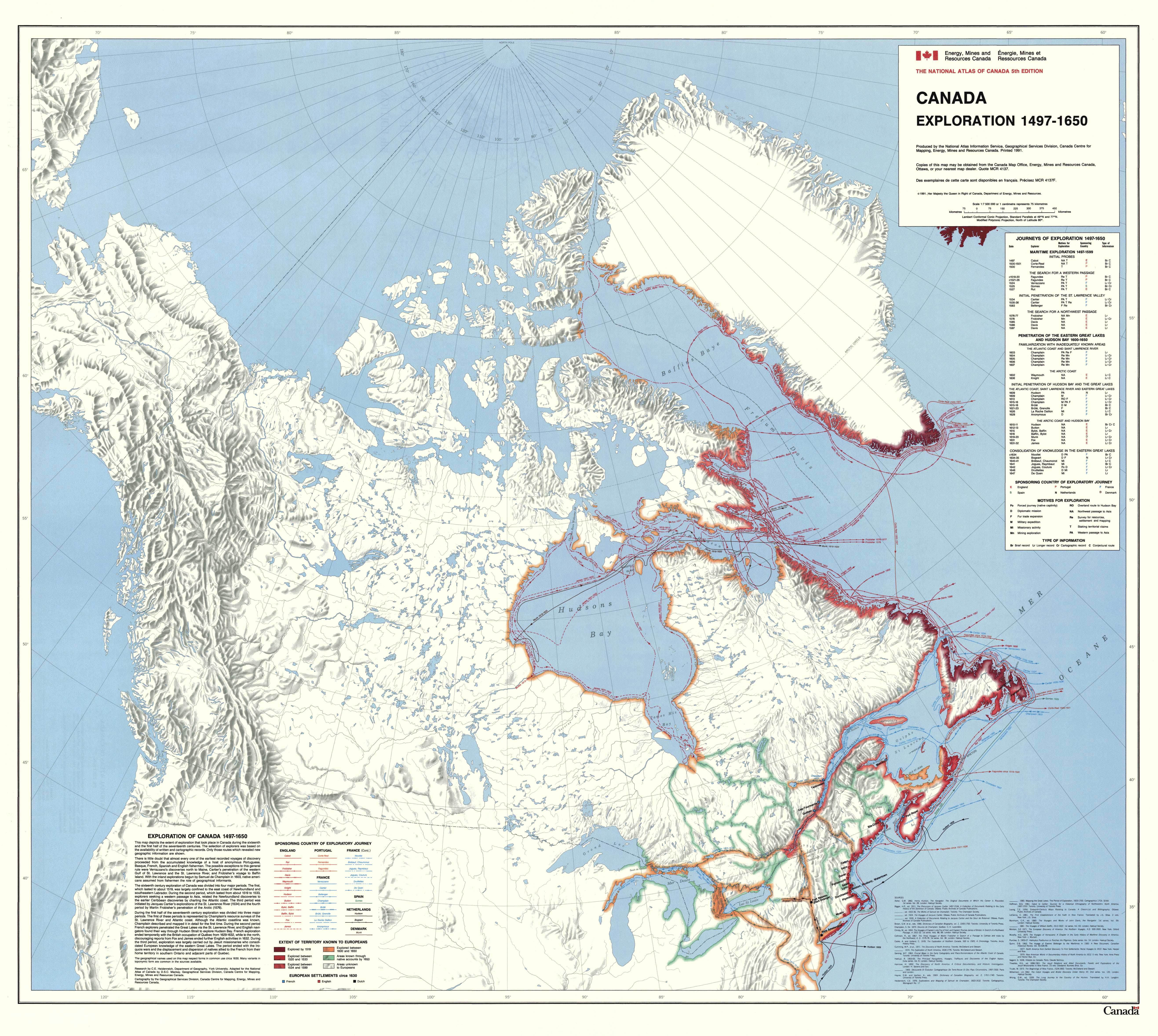
This is a map of explorers - Please click on the map above for a new page with a large, detailed Map.
1497-1650
This is a map of explorers - Please click on the map above for a new page with a large, detailed Map.
1497-1906
This is a map of explorers - Please click on the map above for a new page with a large, detailed Map.
1524-1912
This is a map of explorers - Please click on the map above for a new page with a large, detailed Map.
1534-1870
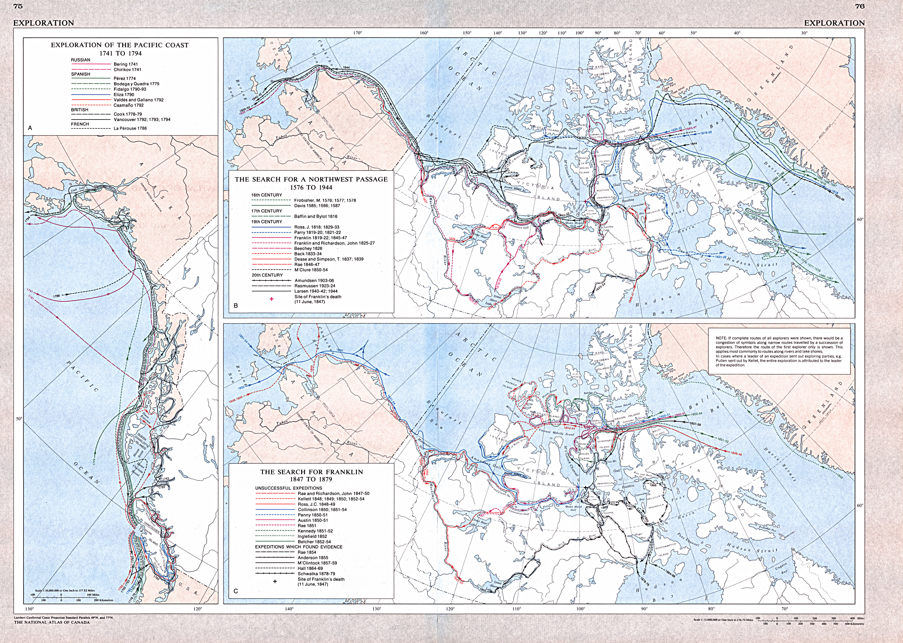
This is a map of explorers - Please click on the map above for a new page with a large, detailed Map.
1576-1944
This is a map of explorers - Please click on the map above for a new page with a large, detailed Map.
Arctic
This is a map of explorers - Please click on the map above for a new page with a large, detailed Map.